 CNR-ISMAR
marine litter
Type of resources
Topics
INSPIRE themes
Keywords
Contact for the resource
Provided by
Years
Formats
Representation types
Update frequencies
status
-
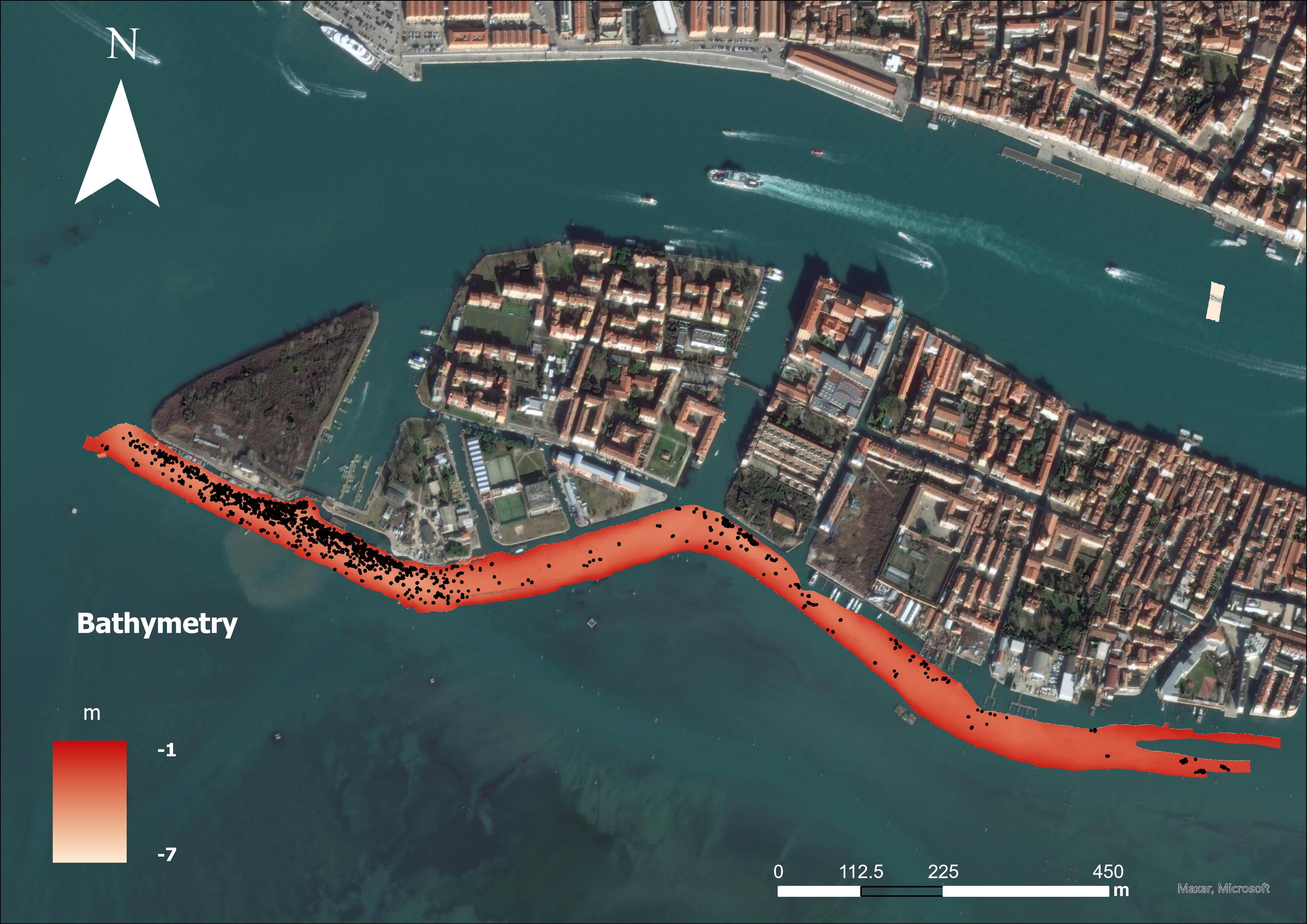
Shape files con il marine litter identificato mediante sia mediante riconoscimento manuale sia mediante l'utilizzo di un workflow in ArcGis applicato alla batimetria di input
-
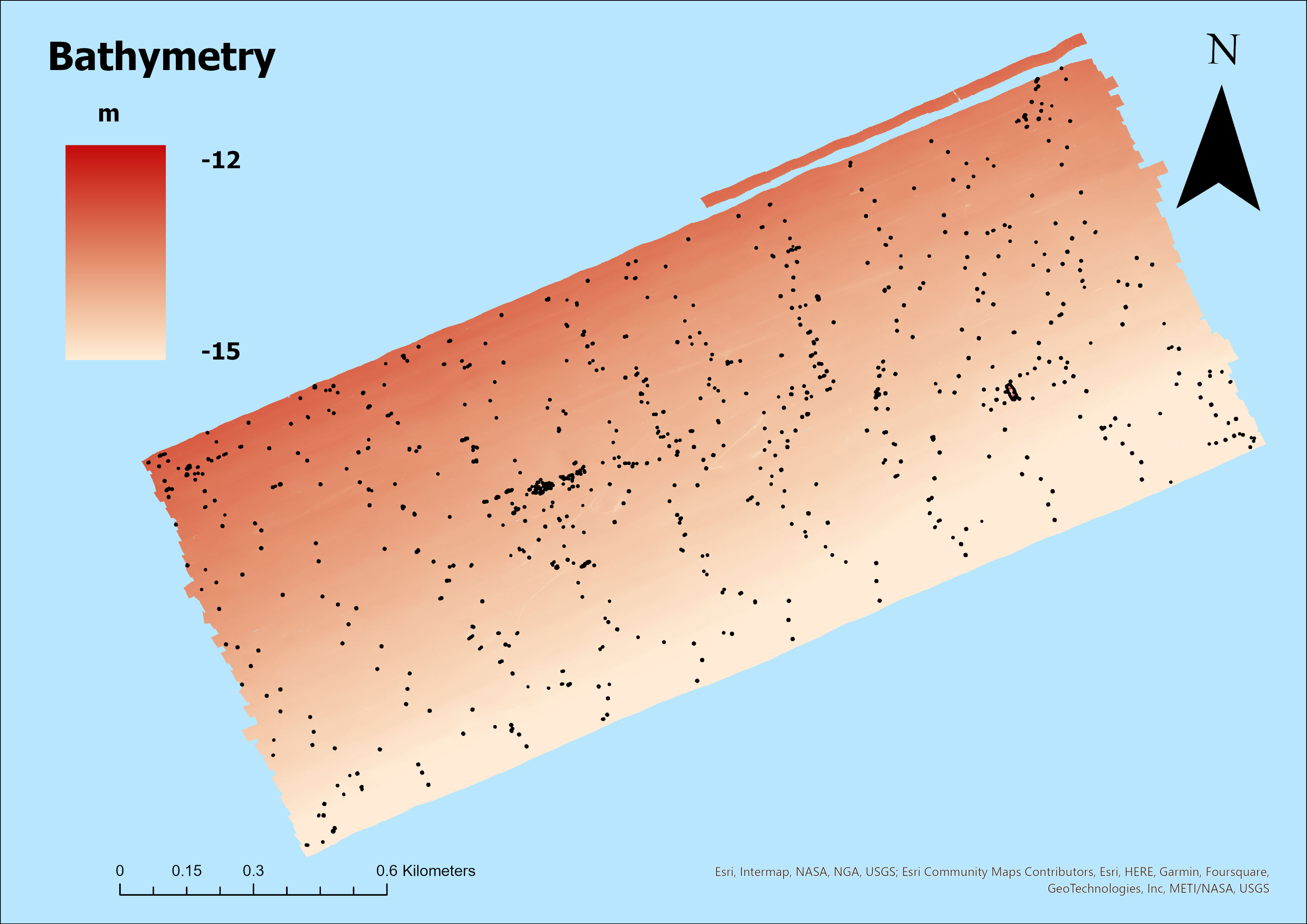
Shape files con il marine litter identificato mediante sia mediante riconoscimento manuale sia mediante l'utilizzo di un workflow in ArcGis applicato alla batimetria di input
-
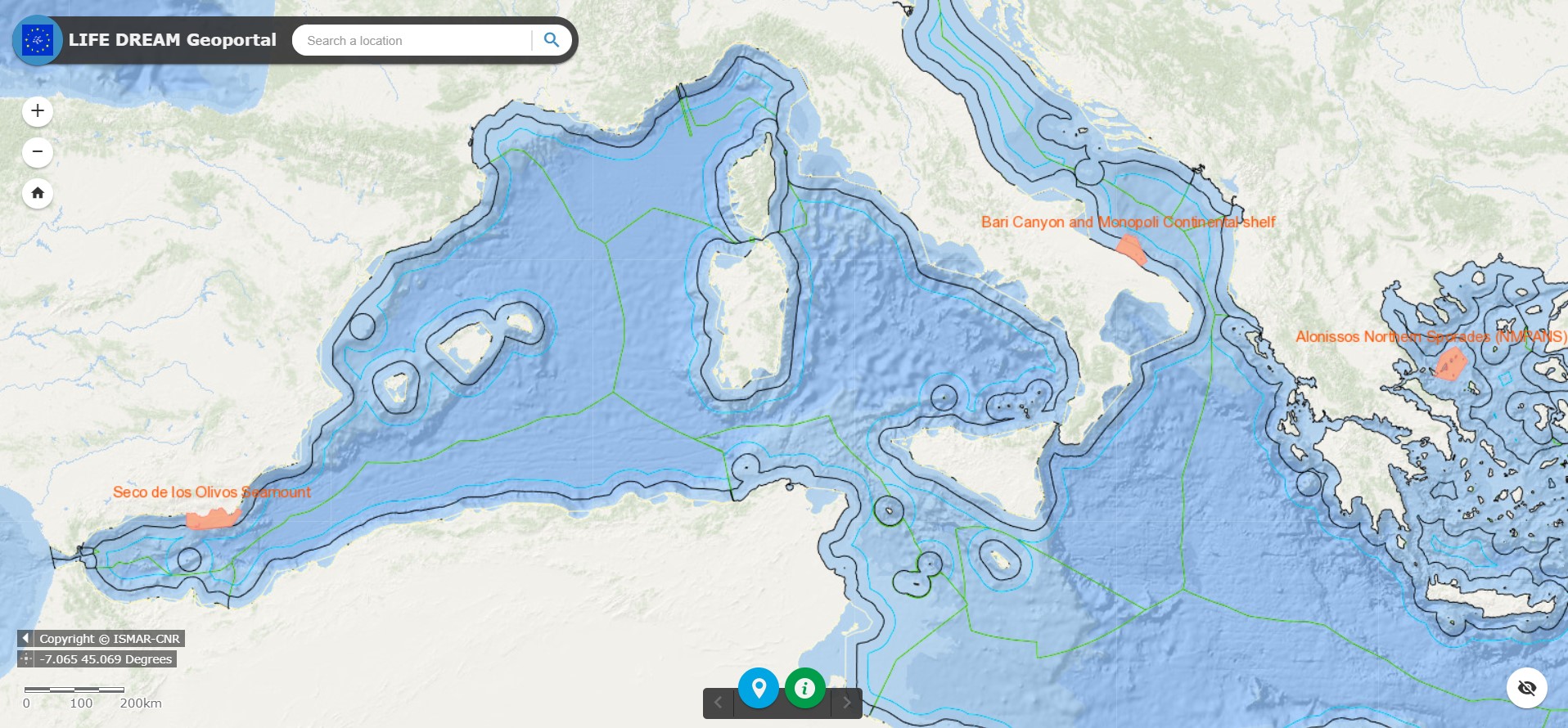
Geoportal implemented in the framework of the LIFE DREAM Project to manage multidisciplinary spatial data at Project Area scale
-
The cruise aimed to map with the multibeam the Gulf of Naples testing the new instruments installed on board Gaia Blue and to produce a high resolution and updated morphobathymetric map of the area to be compared with the existing data.
-
The EU’s biodiversity strategy for 2030 promotes the recovery of the biodiversity of European natural ecosystems through extending conservation networks, preventing and reducing anthropic impacts, and restoring the degraded natural heritage. Marine Deep Reefs (DR) are ecologically relevant benthic habitats acting as CO2 sinks and attracting a highly diverse associated fauna. The multiple pressures DR are currently facing (e.g., climate change, fishery and littering) make the need to protect and restore these habitats more urgent. Marine Litter (ML) can affect the health status of DR, leading to the loss of associated ecological functions. Through an innovative, sustainable approach, the LIFE DREAM Project aims at mitigating the anthropic pressure on deep sensitive habitats (DR) and promoting their protection, recovery and preservation. LIFE DREAM will comprise active intervention to aid the regeneration of DR and will provide supporting information to extend the Natura 2000 network to the deep-sea by integrating biological data on DR and ecosystems services they supply with spatial data on human activities. Active restoration (deployment of artificial structure as substrate for DR the forming-species growth) will be integrated with passive restoration activities (ML removal in correspondence of DR). The involvement of fishers and stakeholders within LIFE DREAM activities intends to enhance the impact of the project and boost a social behavior change. Following the principles of the circular economy, among the ambitions of the Project is pairing the recovery with recycling of materials at the end of their lifecycle, converting the recovered ML in 2nd generation fuel that will reduce the CO2 emissions. The results of LIFE DREAM would represent the baseline to extend the Natura 2000 network to the deep Mediterranean Sea and to restore deep sensitive habitats by providing best practices for DR restoration and the related costs and benefits.
-

Lo scopo della campagna oceanografica SAND16 è stato quello di studiare e caratterizzare le strutture marine profonde, in particolare i canyon lungo i margini continentali, sia da un punto di vista biologico che geologico. I dati raccolti servono a studiare e definire le seguenti tematiche: impatti antropici (marine litter), biodiversità di meiofauna, macrofauna e fauna microbica, seafloor integrity e interazioni tra gli organismi (reti trofiche), diversità procariotica, identificazione dei microrganismi mediante tecniche di Next Generation Sequencing (NGS), quantificazione e caratterizzazione delle microplastiche, studio dei biofilm microbici associati a tali microplastiche, studio della morfologia e delle strutture sedimentarie associate ai canyon e alle frane sottomarine lungo i margini continentali. Le aree di indagine sono state definite attorno ai canyon di Tricase, Crotone e Squillace e i campioni sono stati raccolti a monte dei canyon, in mezzo e al fondo e, come punti di controllo, nelle adiacenti aree esterne al sistema canyon. Durante la campagna siamo riusciti a raccogliere materiale sufficiente ad ottenere informazioni importanti su alcuni degli undici descrittori della marine strategy, e nello specifico: biodiversità, sea floor integrity, reti trofiche, marine litter. Inoltre sarà possibile studiare la diversità microbica, la presenza di microplastiche e i batteri ad esse associati. Il rilievo geofisico delle aree studiate è risultato fondamentale per la strategia di esplorazione delle aree selezionate e nella definizione dei punti di campionatura. I profili multibeam e chirp acquisiti vanno inoltre ad arricchire la conoscenza dei sistemi sedimentari associati ai margini continentali.